
Property Search Maps: Interactive POI & Routing API
For Sale
£1,975,000
Freehold · Victorian End-of-Terrace
14 The Vineyard, Richmond, Surrey TW10 6AQ
4
Beds
3
Baths
2
Recepts
2,150
Sq ft
70ft
Garden
Property Description
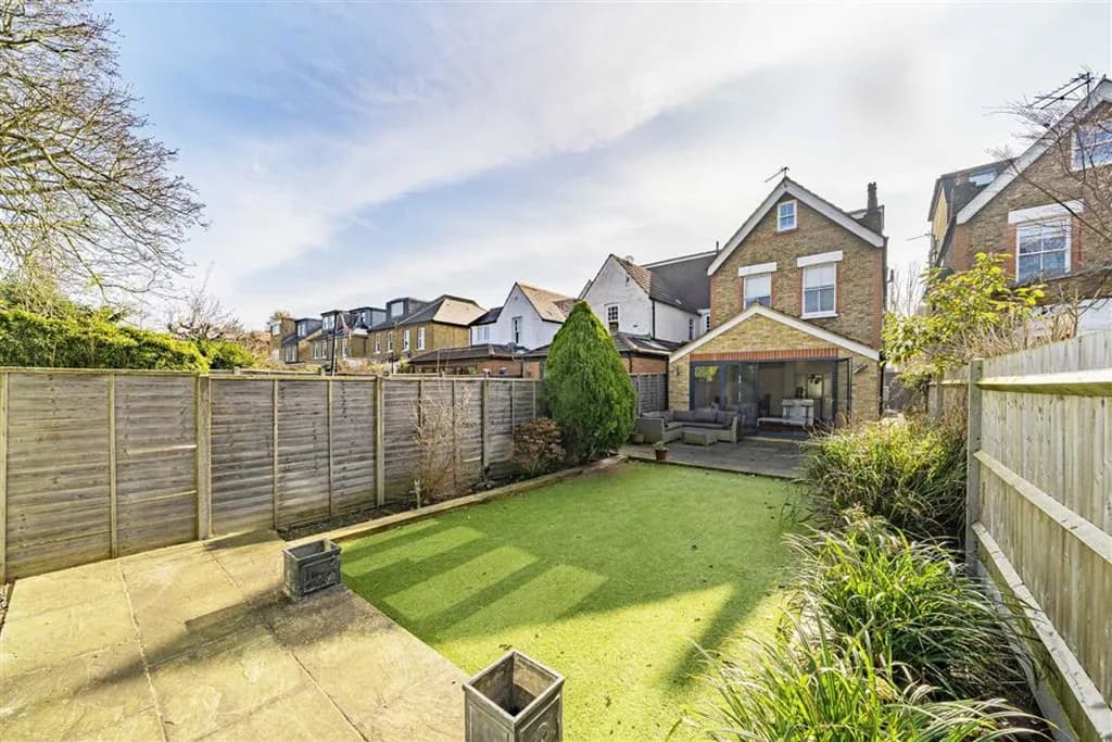
A stunning four-bedroom Victorian end-of-terrace townhouse perfectly positioned on The Vineyard, one of Richmond's most sought-after residential streets. This beautifully presented family home combines period elegance with contemporary luxury, featuring high ceilings, original fireplaces, and a south-facing garden. The property has been extensively renovated to an exceptional standard while retaining its historic charm.
Key Features
Outstanding primary school adjacent (2 min walk)
Richmond Station 3 min walk, District · Overground · National Rail
Original Victorian fireplaces in reception rooms
70ft south-facing landscaped garden
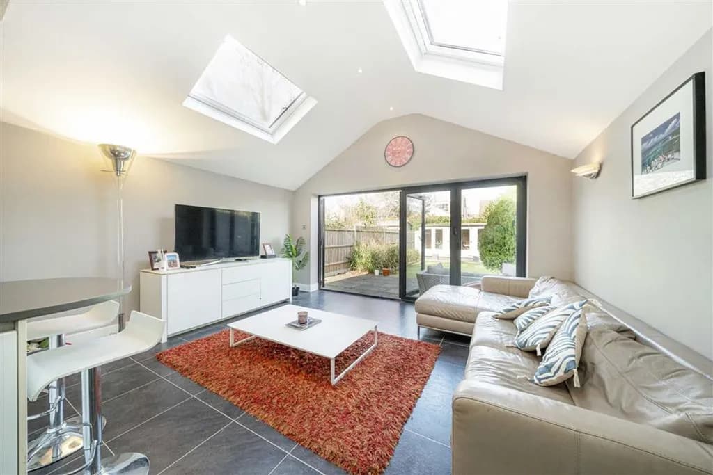
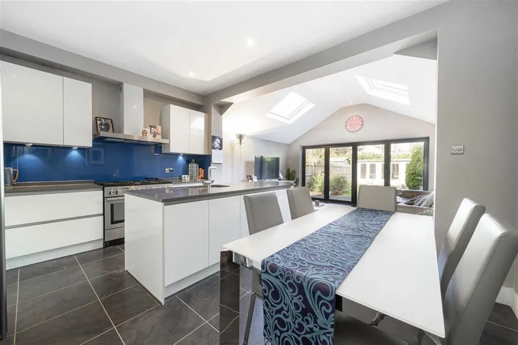
Contemporary open-plan kitchen/family room with bi-folds
Richmond Park 6 min cycle, 2,500 acres off-lead dog walking
Principal suite with dressing room and luxury en-suite
Detached double garage with EV charging point
Miele appliances, Silestone quartz worktops
Council Tax Band G · EPC rating D (potential B)
Transport Links
Richmond
DistrictOvergroundNat Rail
0.2 mi3 min walk
Kew Gardens
District
1.3 mi25 min walk · 6 min cycle
St Margarets
SWR
0.9 mi18 min walk
London Waterloo
via Richmond
38 min direct
Nearby Schools
The Vineyard Primary School
Primary · Ages 4–11
Grey Court School
Secondary · Ages 11–18
Sheen Mount Primary
Primary · Ages 4–11
Christ's School
Secondary · Ages 11–18
Why Richmond?
2,500
acres Richmond Park
4.9/5
area quality score
38 min
to Waterloo direct
3
Outstanding schools
Sale History
DatePriceType
Sep 2018£1,625,000Freehold
Mar 2011£1,050,000Freehold
Nov 2004£715,000Freehold
Estimated current value: £1,940,000–£2,010,000 based on comparable TW10 sales
Common questions about Property Discovery
How real estate teams use MapAtlas to surface neighbourhood context for every listing.
What is property location intelligence?
Property location intelligence is the practice of layering geographic context over a real estate listing: nearby transit, schools, parks, shops, restaurants, walk and drive times, plus environmental and demographic signals. It turns a listing from a feature list into a "what is it like to live here" answer that buyers and tenants actually need before they book a viewing.
How is Property Discovery different from a generic map?
A generic map shows roads and pins. Property Discovery is a curated layer of POIs ranked by relevance for residential decisions: train stations with walk times, supermarkets, gyms, schools with catchment information, parks and green space. Each POI carries distance, walk time, and contextual metadata so it can be displayed inline on the listing page or returned via API.
Can Property Discovery embed inside an existing listing page?
Yes. The product ships as both a hosted React component and a JSON API. You can drop the interactive map into any listing detail page or pull the structured POI data into your own UI. Both modes use the same underlying data, so the API response and the embedded map stay in sync.
Which countries does Property Discovery cover?
Coverage spans the United Kingdom and the European Union by default, with extended coverage available for North America and APAC on request. POI density is highest in major metros but the underlying data continues out to small towns thanks to OpenStreetMap and proprietary enrichment.
Does Property Discovery include school catchment areas?
Yes for the UK and select EU markets where catchment data is publicly available. Each school POI returns the catchment polygon (where applicable), the OFSTED or local equivalent rating, and walk time from the property. For markets without official catchments we surface distance-ranked schools instead.
How is the data kept up to date?
POIs are refreshed weekly from OpenStreetMap plus partner feeds, and listings can be re-enriched on demand via the API. School ratings and transit timetables follow the upstream source cadence (typically monthly). Cached responses include a freshness timestamp so portals can decide when to re-query.
Is Property Discovery GDPR compliant?
Yes. All POI data is publicly sourced and the API does not log end-user IPs or personal information by default. Hosting is in the EU and a Data Processing Addendum is available on request. The product is designed for EU listing portals, so GDPR compliance is the default rather than an opt-in.
How is Property Discovery priced?
Pricing is per listing enriched, with included POI categories and a generous monthly free tier for small portals. Higher tiers add advanced categories (commute matrices, environmental layers) and white-glove onboarding. See the pricing page for current tier details.